Unlock Version
Lock Version
Changelog for QGIS 3.8

Release date: 21 June, 2019
QGIS 3.8 brings an extensive list of new changes and a lot of polishing of existing features - the highlights of which we will try to cover here. As always can we remind you that QGIS is an open source project and if you are able to, consider supporting our work through donations, sponsorship or contributions to the code documentation, web site and so on.
Thanks
We would like to thank the developers, documenters, testers and all the many folks out there who volunteer their time and effort (or fund people to do so). From the QGIS community we hope you enjoy this release! If you wish to donate time, money or otherwise get involved in making QGIS more awesome, please wander along to qgis.org and lend a hand!
QGIS is supported by donors and sponsors. A current list of donors who have made financial contributions large and small to the project can be seen on our donors list. If you would like to become an official project sponsor, please visit our sponsorship page for details. Sponsoring QGIS helps us to fund our six monthly developer meetings, maintain project infrastructure and fund bug fixing efforts. A complete list of current sponsors is provided below - our very great thank you to all of our sponsors!
QGIS is Free software and you are under no obligation to pay anything to use it - in fact we want to encourage people far and wide to use it regardless of what your financial or social status is - we believe empowering people with spatial decision making tools will result in a better society for all of humanity.
Notable Fixes
You can now export curved geometry layers to DXF format without segmentizing the features — no more loss of curves!
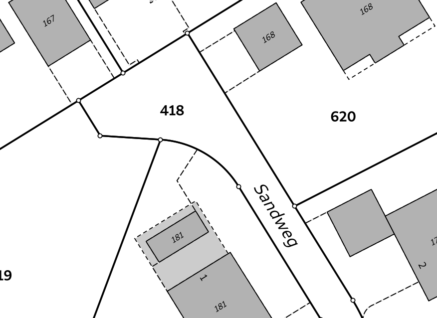
This feature was funded by Kanton Schaffhausen
This feature was developed by Jürgen Fischer in collaboration with Matthias Kuhn
| Bug Title | URL issues.qgis.org (if reported) | URL Commit (Github) | 3.4 backport commit (GitHub) |
|---|---|---|---|
| Raster Calculator wrong results | #21405 | fixed in master | |
| QGIS server ignores custom rendering order when loading parent group | #21917 | PR #9878 | Done |
| WMS Client: GetFeatureInfo in JSON format doesn't display numeric attribute values | #21735 | PR #9879 | Done |
| Crash when adding New Field to ShapeLayer | #22100 | ||
| Priority in labelling not greyed out when data defined settings are enabled | #22077 | Invalid | |
| $length return bad value | #22105 | works for me (and for everybody) | |
| Relation reference widget wrong feature when "on map identification" | #22071 | ||
| Map composer: "href" HTML attribute issue in PDF output | #22075 | won't fix | |
| Issue exporting raster layer to Geopackage | #20848 | PR #10036 | Done |
| Create vector New shapefile POLYGON | #22107 | invalid | |
| "Export to PostgreSQL" python error if rather schema has an uppercase letter in its name | #22035 | PR #10063 | |
| Relation reference widget wrong feature when "on map identification" | #22071 | PR #10047 | Done |
| DB Manger imports the wrong data | #22033 | PR #10077 | Done |
| qgis crash when filtering a layer with an attachment field | #21775 | Fixed by Nyall | |
| Raster calculator, abs() not working | #29824 | PR #29965 | Done |
| Valid file URL link fails in Identify window | #29879 | PR #29967 | Done |
| QgsProject.instance().clear() crashes QGIS when LayoutDesigner Window is open | #29821 | PR #29968 | Done |
| QGIS Server WFS DescribeFeatureType advertises double precision virtual fields as integer | #29767 | PR #29970 | Done |
| QGIS crahses when exporting a template | #29798 | PR #29981 | Done |
| Export atlas as image fail when expression filename contain dot | #29980 | PR #29983 | Done |
| Buttons to adjust marker size in the digitizing tab of the general settings dialog not work | #29987 | PR #29991 | |
| Map Composer crashes QGIS when copying mixture of elements in page layout | #29747 | PR #30017 | TODO |
| QGIS crashes with PostgreSQL views | #29673 | cannot reproduce and cannot ask for feedback | |
| Browser - "Project home" folder shortcut does not appear when a new project is saved | #29919 | PR #30025 | TODO |
| Crash when calling QgsRasterHistogram.histogramVector | #29700 | PR #30033 | Done |
| Do not offer to "Import settings from Qgis2?" if no such settings exist | #30082 | PR #30092 | Done |
| In gpkg, query builder prevents autogenerate of pasted feature with same fid as hidden feature | #30062 | PR #30096 | TODO |
| Drag and drop geopackage from filesystem into map misses vector layers, loses names for raster layers | #30050 | PR #30098 | Done |
| Qgis crashes when try to identify a layer with duplicated fields | #29937 | PR #30100 | TODO |
| label properties will not saved to project files (buffer and background) | #29882 | works for me on release-3_4 and master | |
| Saving edits to a layer with JSON field throws an error | #30131 | PR #30137 | Risky? |
| Value relation widget settings lost on import of layer definition file | #30115 | PR #30151 | Risky? |
| Unable to add new features in QGIS for PostGIS table using sequence for gid. Data type serial: 'integer overflow' | #30041 | PR #30184 | Done |
This feature was funded by QGIS.ORG donors and sponsors
This feature was developed by Alessandro Pasotti
| Bug Title | URL issues.qgis.org (if reported) | URL Commit (Github) | 3.4 backport commit (GitHub) |
|---|---|---|---|
| v.net.distance - node cost column | #22013 | PR #10060 | Done |
| shapefile to raster conversion does not work | #21922 | ||
| GRASS r.in.lidar.info, can only choose .txt not the intended .las | #21910 | PR #10061 | Done |
| SAGA OpenCV Image Analysis | #21746 | ||
| SAGA "saga split rgb bands" tool is not inside any (SAGA) group of tools | #21849 | PR #10062 | Done |
| r.sun cannot be executed because it calls on two incompatible options | #21637 | PR #10074 | Done |
| i.segment (GRASS 7.4.2) only produces a Goodness Raster but no Segmented Raster | #20646 | works fine in master and 3.4 | |
| Majority filter (SAGA) returns erroneous results if input is .tif | #22118 | invalid | |
| Processing batch process interface: no way to go back | #16893 | PR #10080 | Done |
| DB Manager rename PostGIS column error | #21425 | PR #10082 | not needed |
| Word wrapping not working in maptips | #21388 | PR #10081 | Done |
| Styles stored in QML files with same name as layer no longer auto loaded | #21691 | PR #14660 | Done |
| QGIS 3.4.6 crashed when I tried classifying a layer | #21693 | PR #29951 | Done |
| Fixed table not working under User defined filter (SAGA) | #29999 | PR #30001 | Done |
| DB Manager Versioning: _current view lacks primary key | #25888 | PR #30045 |
This feature was funded by QGIS.ORG donors and sponsors
This feature was developed by Alexander Bruy
| Bug Title | URL issues.qgis.org (if reported) | URL Commit (Github) | 3.4 backport commit (GitHub) |
|---|---|---|---|
| Processing "iterate" does not work anymore | #21524 | PR #10078 | |
| parameter type error in SAGA Gaussian Filter | #21797 | Commit | |
| Distance matrix does not maintain data type and precision for Input Point Layer in Linear (N*k x 3) | #21501 | ||
| Processing "Build virtual vector" now fails in certain cases | #21519 | PR #10083 | |
| SAGA raster calculator loads more grids than selected when a sdat is supplied in XGRIDS | #22131 | PR #10085 | |
| Export selected Objects generated line layer not selectable in graphical modeller | #21705 | PR #10093 | |
| Batch processing error in r.mapcalc.simple | #29822 | ||
| Help for algorithms not visible in modeller | #21536 | ||
| Bug fixes related the batch interface, not linked to any bug report. They are regressions introduced in recent changes, that i found while working on another issue | PR #29948 | ||
| PR #29950 |
| Bug Title | URL issues.qgis.org (if reported) | URL Commit (Github) | 3.4 backport commit (GitHub) |
|---|---|---|---|
| ENVI driver ignores "geo point" (GCP) metadata on reading | #1528 | Commit | |
| WFS GetFeature fails on TypeNames parameter | #21768 | PR #29946 | Done |
| Cannot load GPX file automatically after creating it QGIS 3.4.7 QGIS 3.6.2 | #22005 | PR #29947 | Done |
| Cannot create temporary SpatiaLite cache | #29819 | PR #29949 | Done |
| PostGIS closed circle in Curved Polygon is not displayed | #29895 | PR #30010 | Done |
| Fix GeoJSON output of MultiPolygon/MultiSurface | PR #30012 | PR #30012 | Not needed |
| Multipatch features are not shown anymore | #29376 | PR #30024 | Done |
| Multiple issues and deadlocks with WFS | #29258 | PR #30026 | Done |
| WFS provider: Avoid dangling download progress dialog | PR #30039 | PR #30039 | Done |
| Bug Title | URL issues.qgis.org (if reported) | URL Commit (Github) | 3.4 backport commit (GitHub) |
|---|---|---|---|
| Editing a GeoPackage feature with spaces in the field names can crash QGIS | #29630 | PR #29997 | TODO |
| Crash on update pg layer | #29814 | duplicate | N/A |
| XMDF file type missing from Madiera 3.4.5 | #29381 | invalid | N/A |
| Mesh calculator: crash when 'All Selected Dataset Times' button clicked | #30003 | PR #30005 | N/A |
| Crash when editing fields | #29200 | unable to replicate | N/A |
| Closing Vertex Edititor crashes the app | #30028 | PR #30030 | TODO |
| Detached 3D view crash [macOS] | #29169 | unable to replicate |
| Bug Title | URL issues.qgis.org (if reported) | URL Commit (Github) | 3.4 backport commit (GitHub) |
|---|---|---|---|
| No snap when selecting point of rotation | #29706 | duplicate / not a bug | |
| Crashs when working with auxiliary storage label and data defined | #30078 | unable to replicate | |
| Improve the advanced digitizing by angle | #30133 | not a bug | |
| Fix reshape for snapped point with Z | PR #30108 |
This feature was funded by QGIS.ORG donors and sponsors
This feature was developed by Loïc Bartoletti
| Bug Title | URL issues.qgis.org (if reported) | URL Commit (Github) | 3.4 backport commit (GitHub) |
|---|---|---|---|
| Fix string values are always repeated in expression build field value list | unreported | Commit | N/a |
| Fix priority of parallel label placements, avoid placing labels below lines accidentally | unreported | Commit | Done |
| Fix collecting geometries when one of the added geometries is already multipart | #30208 | Commit | Done |
| [processing] Fix missing default value for Select by Expression | #30218 | Commit | Done |
| [processing] Fix exception in select by expression using not equal to operator | #30135 | Commit | Done |
| Fix attribute table filtering to items within atlas feature when atlas feature has a different CRS to table layer | Unreported | Commit | Done |
| Avoid sqlite database lookup on EVERY https network request | Unreported | Commit | Done |
| [layouts] Fix filtering of attribute table to visible features when linked map is rotated | Unreported | Commit | Done |
| Fix crash when closing QGIS with open layout designer windows | Unreported | Commit | Done |
| Fix inverted polygon is distorted when map is rotated | #26381 | Commit | Done |
| Fix incorrect bounding box of labels used when map is rotated | #24680 | Commit | Done |
| Fix cannot use labeling map tools when canvas is rotated | #25384 | Commit | Done |
| Fix exception in BatchAlgorithmDialog | Unreported | Commit | N/A |
| Don't limit label distances to postive values | Unreported | Commit | Done |
| Fix curved labels sometimes placed below line even when set to above line only | Unreported | Commit | Done |
| Fix curved labeling fails when line feature geometry begins with small segments | #28699 | Commit | Done |
| Fix some curved labels randomly disappear at certain scales | #12173 | Commit | Done |
| Ensure "merge connected features" setting works correctly with line networks that contains forks and branches | #12173 | Commit | Done |
| Fix missing labels when multilinestring features are used in conjunction with the "merge connected lines" setting | #12173 | Commit | Done |
| Rework new project CRS handling | #27516 | Commit | Done |
| Fix offset labels from reprojected layers when map is rotated | #24796 | Commit | Done |
| Fix labeling ignores "label per part" setting when geometry parts are adjacent | #26763 | Commit | Done |
| Fix crash when filtering layer with attachment field | #21775 | Commit | Done |
| Regenerate distance area calculation on demand in attribute table | #25500 | Commit | Done |
| Fix dxf export ignores multisurface geometry types | #21779 | Commit | Done |
| Avoid resetting column selection when restoring project with an atttribute table set to the "atlas feature" source | #20538 | Commit | Done |
Import PR from Github into Entries