Unlock Version
Lock Version
Changelog for QGIS 3.8

Release date: 21 June, 2019
QGIS 3.8 brings an extensive list of new changes and a lot of polishing of existing features - the highlights of which we will try to cover here. As always can we remind you that QGIS is an open source project and if you are able to, consider supporting our work through donations, sponsorship or contributions to the code documentation, web site and so on.
Thanks
We would like to thank the developers, documenters, testers and all the many folks out there who volunteer their time and effort (or fund people to do so). From the QGIS community we hope you enjoy this release! If you wish to donate time, money or otherwise get involved in making QGIS more awesome, please wander along to qgis.org and lend a hand!
QGIS is supported by donors and sponsors. A current list of donors who have made financial contributions large and small to the project can be seen on our donors list. If you would like to become an official project sponsor, please visit our sponsorship page for details. Sponsoring QGIS helps us to fund our six monthly developer meetings, maintain project infrastructure and fund bug fixing efforts. A complete list of current sponsors is provided below - our very great thank you to all of our sponsors!
QGIS is Free software and you are under no obligation to pay anything to use it - in fact we want to encourage people far and wide to use it regardless of what your financial or social status is - we believe empowering people with spatial decision making tools will result in a better society for all of humanity.
3D Features
Like all recent QGIS releases, in version 3.8 we've significantly boosted QGIS' 3D rendering capabilities. New 3D rendering features include:
- Configurable line width (in screen units) for "simple" 3D lines (in previous versions they were always 1px wide)
- Optional highlighting of edges of 3D polygons
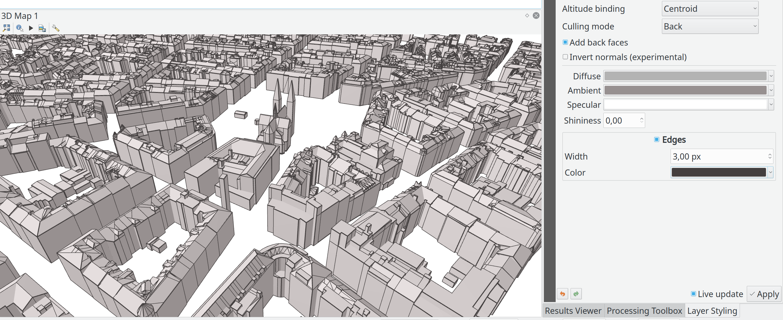
This feature was funded by Andreas Neumann
This feature was developed by Martin Dobias (Lutra Consulting)
Another exciting change we've introduced in QGIS 3.8 is the ability to export your 3D animations! These are exported as a series of png/jpg/... images, which can be easily merged into .avi or other standard video files (using external tools).
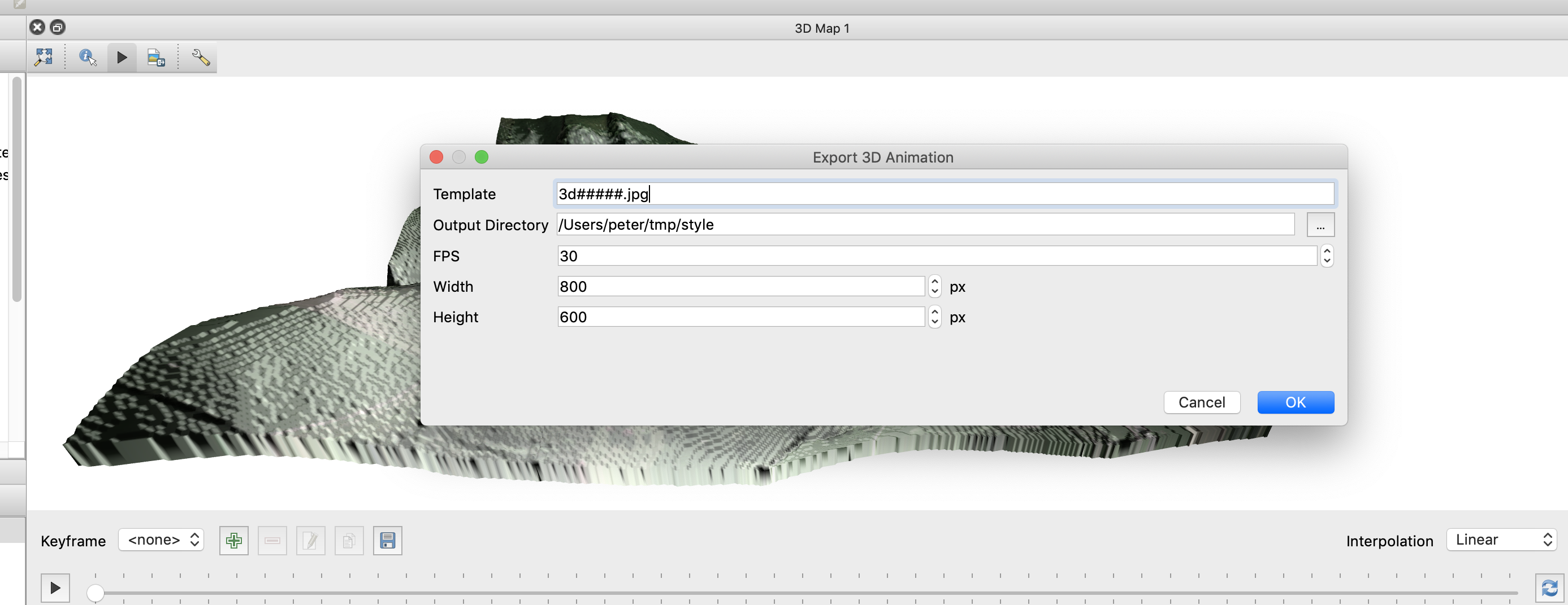
This feature was funded by Northumberland National Park Authority
This feature was developed by Peter Petrik (Lutra Consulting)
With this new version 3.8 feature, you can now directly fetch terrains for your 3D scenes from online sources (e.g. tiles hosted on AWS). No more sourcing and preparing rasters with DEM, just enable this option and see beautiful 3D scenes out-of-the-box!
This feature was funded by Crowdfunding: More QGIS 3D
This feature was developed by Martin Dobias (Lutra Consulting)
In QGIS 3.8, the field of view of the camera through which 3D scenes are rendered has gained a new configurable field of view settings.
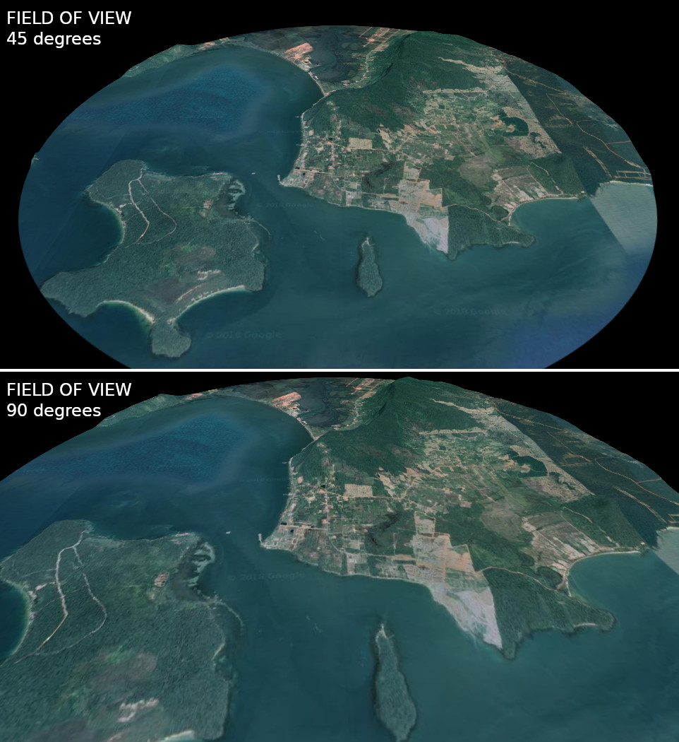
This feature was developed by Mathieu Pellerin
Import PR from Github into Entries