Unlock Version
Lock Version
Changelog for QGIS 3.8

Release date: 21 June, 2019
QGIS 3.8 brings an extensive list of new changes and a lot of polishing of existing features - the highlights of which we will try to cover here. As always can we remind you that QGIS is an open source project and if you are able to, consider supporting our work through donations, sponsorship or contributions to the code documentation, web site and so on.
Thanks
We would like to thank the developers, documenters, testers and all the many folks out there who volunteer their time and effort (or fund people to do so). From the QGIS community we hope you enjoy this release! If you wish to donate time, money or otherwise get involved in making QGIS more awesome, please wander along to qgis.org and lend a hand!
QGIS is supported by donors and sponsors. A current list of donors who have made financial contributions large and small to the project can be seen on our donors list. If you would like to become an official project sponsor, please visit our sponsorship page for details. Sponsoring QGIS helps us to fund our six monthly developer meetings, maintain project infrastructure and fund bug fixing efforts. A complete list of current sponsors is provided below - our very great thank you to all of our sponsors!
QGIS is Free software and you are under no obligation to pay anything to use it - in fact we want to encourage people far and wide to use it regardless of what your financial or social status is - we believe empowering people with spatial decision making tools will result in a better society for all of humanity.
Map Tools
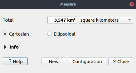
In 3.8, we added an option to the measurement tool which forces Cartesian measurements for distance or area measurements. Previously, the measurement tools always used ellipsoidal/geodesic area and distance calculations, but there's occasions when this is not desirable and users require pure Cartesian calculations instead.
Import PR from Github into Entries