Project: QGIS
Version: 3.2.0
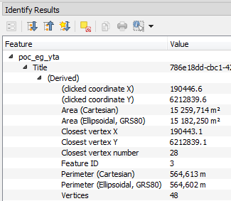
In QGIS 3.2 we now show both ellipsoidal and cartesian areas, lengths and perimeters separately within the identify results panel. Seeing the two distinct measurements gives users a better understanding of potential issues in area or distance calculations caused by incorrect projection or ellipsoid choices.