Project: QGIS
Version: 3.0.0
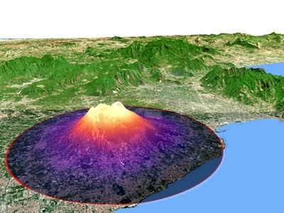
We have a brand new native 3D map view in QGIS! The 3D map view displays 2D map (rendered from project layers) on top terrain. By default the terrain is a flat plane, but it is possible to use raster layers with digital elevation model as the source of height data.
Use menu View > New 3D Map View to add a 3D view of the project. This will create a new dock widget with 3D map canvas. The 3D view uses the same controls like 2D map views to browse the map using mouse (drag map to move it around, mouse wheel to zoom) or keyboard arrow keys. In addition there are camera controls specific to 3D views: it is possible to rotate and tilt camera by one of the following ways:
- by dragging the mouse with middle mouse button pressed
- by pressing Shift and dragging the mouse with left mouse button pressed
- by pressing Shift and using up/down/left/right keys