Project: QGIS
Version: 3.0.0
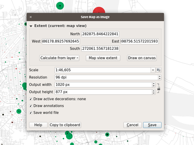
The map canvas' save as image function has been expanded and now offers users the possibility to tweak the scale, resolution, and extent on-the-fly. Extents can be restricted to a height-width ratio. A save as PDF function was also added to quickly export the map canvas into a resolution-independent PDF.
This feature was funded by Andreas Neumann (partial funding)
This feature was developed by Mathieu Pellerin