Project: QGIS
Version: 2.10.0
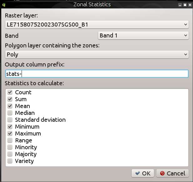
Zonal statistics provide a way to extract aggregate values for the pixels underlying a polygon. The following new features have been added to our zonal statistics tool:
- you can now select which statistics to calculate
- extra statistics have been added (median, standard dev, min, max, range, minority, majority and variety)
- ability to select the raster band to use for statistics extraction
Note that zonal stats is a 'core plugin' (a plugin that ships with your QGIS installer), but is disabled by default. You need to enable it in the plugin manager and then a menu entry for zonal statistics will appear in the Raster menu.