Project: QGIS
Version: 3.10 LTR
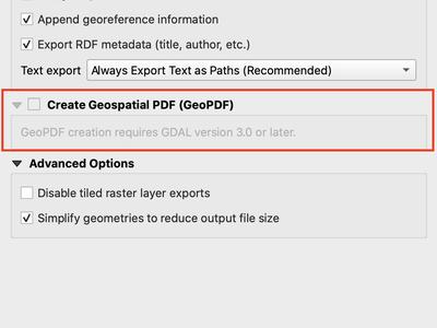
If you export PDF's from QGIS now, there is an option to export it as GeoPDF. If you open this PDF with a compatible PDF viewer, you will then be able to toggle layers on and off, pan and zoom around the PDF and interactively interrogate features! Futhermore, you can re-import these GeoPDF documents back into QGIS as vector layers, and see all the features in their original locations and with their original attribute values.
GeoPDF export is available for either print layouts or map canvas exports. We've added lots of flexibility to this new option, e.g. with options for controlling which layers will be exported as interactive layers. You can even choose to export multiple map themes into a single GeoPDF document, so that your readers can interactive switch between these themes! (Wow!)
Note that GeoPDF export requires a QGIS build based on GDAL 3.0 or later.
Read more at QGIS 3.10 Loves GeoPdf
This feature was funded by GeoPDF export group: Land Vorarlberg; Cantons of Zug, Thurgovia and Neuchâtel; Cities of Vienna and Dornbirn; Biodiversity Information Service for Powys & Brecon Beacons National Park
This feature was developed by Nyall Dawson (North Road)