Project: QGIS
Version: 2.16.0
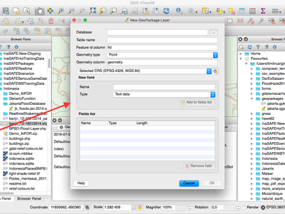
The GeoPackage format is an open standard for geospatial data that should be on your radar as a replacement for the ESRI Shapefile format. It addresses many shortcomings with the shape file format including limitations in the number and width of fields. In QGIS 2.16 it is now easy to create a new GeoPackage as it has been integrated into the Layer toolbar and Layer -> Create Layermenu.
This feature was developed by Even Rouault