Project: QGIS
Version: 2.12.0
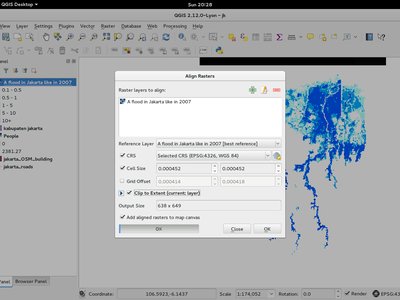
This new tool in qgis_analysis library is able to take several rasters as input and:
- reproject to the same CRS
- resample to the same cell size and offset in the grid
- clip to a region of interest
- rescale values when required
This feature was developed by: Martin Dobias at Lutra Consulting on subcontract to Kartoza This feature was funded by: DFAT for the InaSAFE project