Quantum GIS is now known only as 'QGIS'
New icon theme
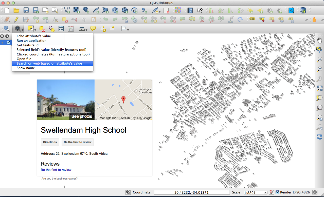
Default action tool
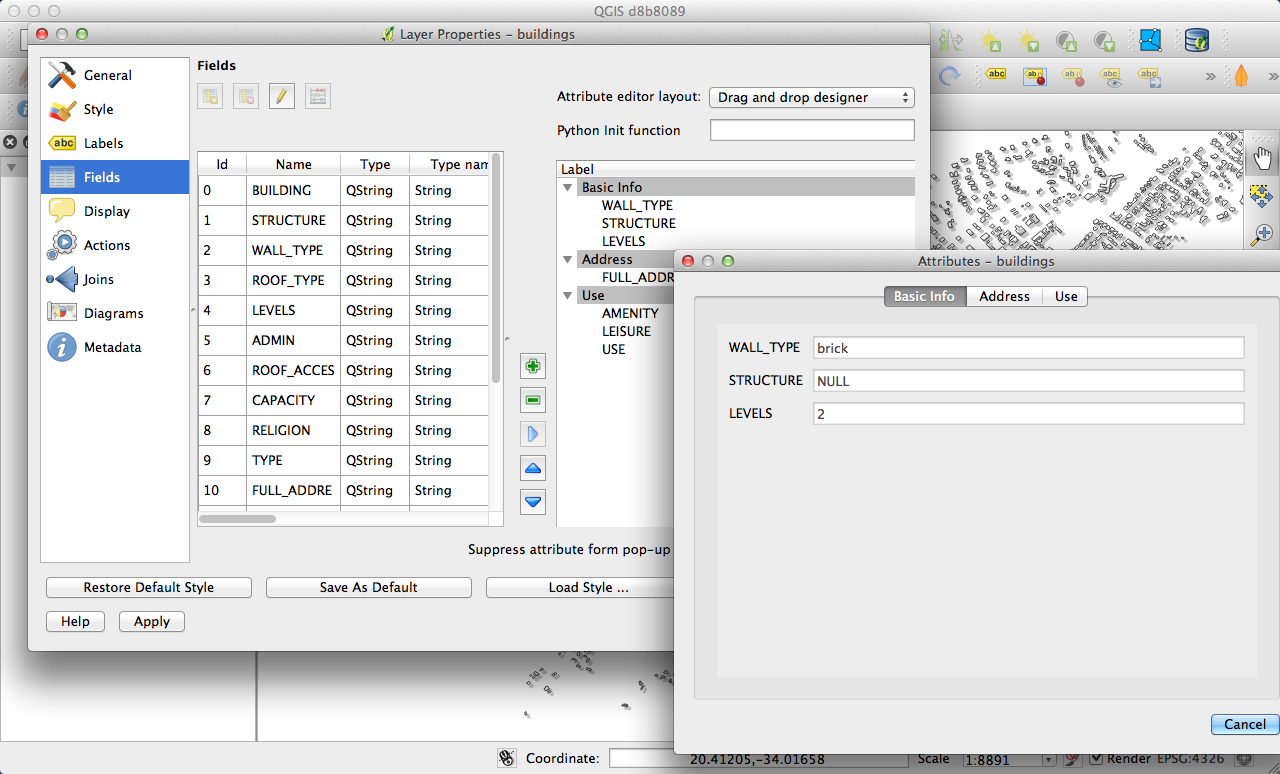
Drag and drop form builder
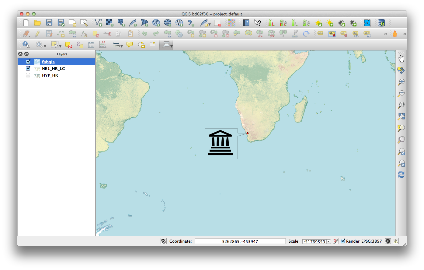
SVG Annotations
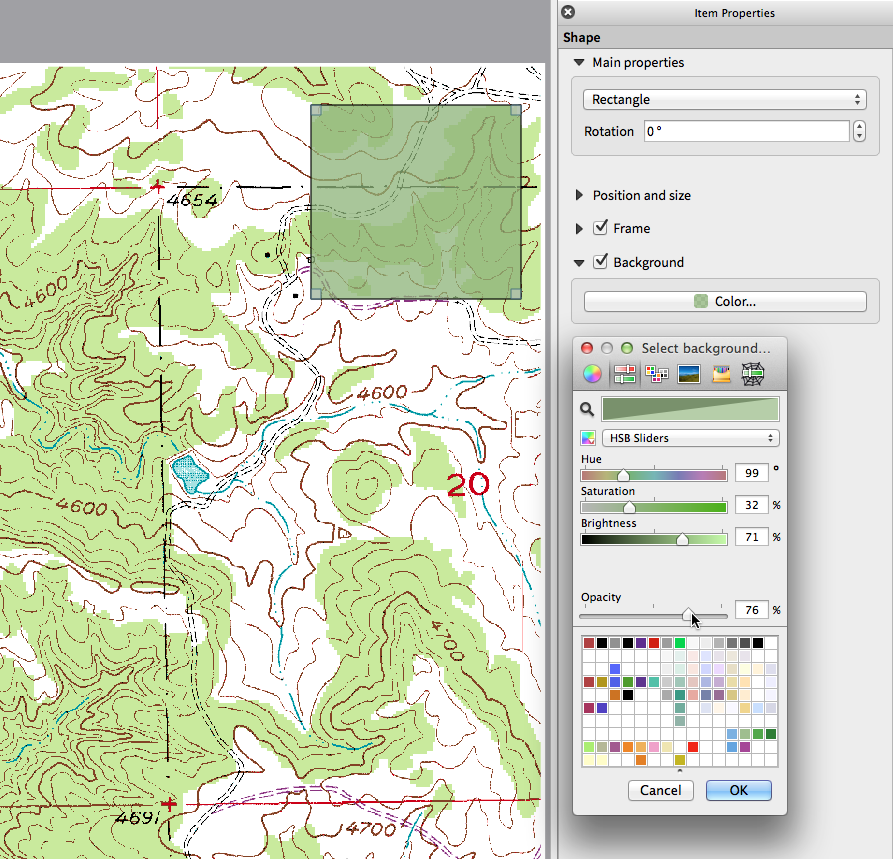
Live color chooser dialogs and buttons
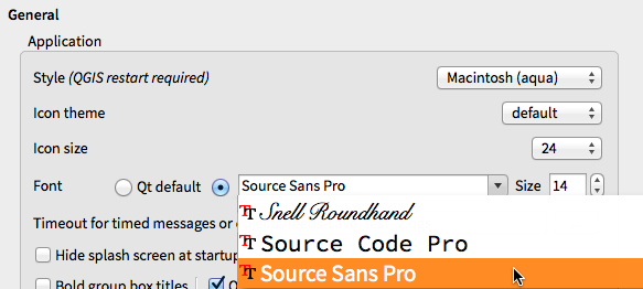
Application custom font and Qt stylesheet
Side tabs, collapsable groups
Soft notifications
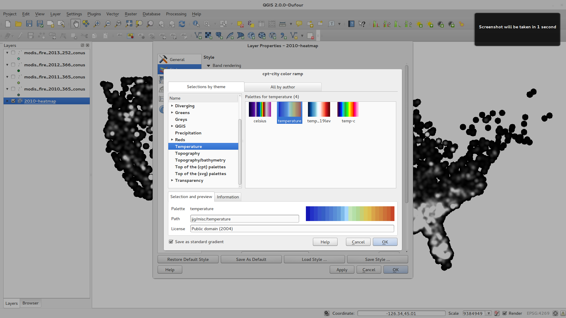
Colour ramp support
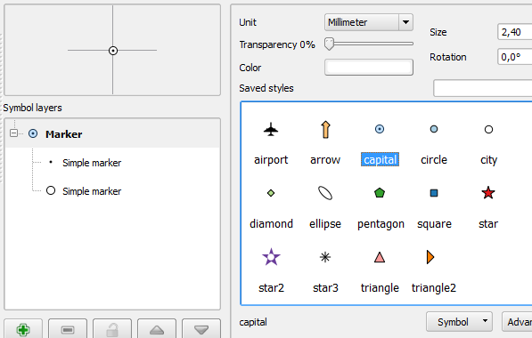
Improved symbol layer management
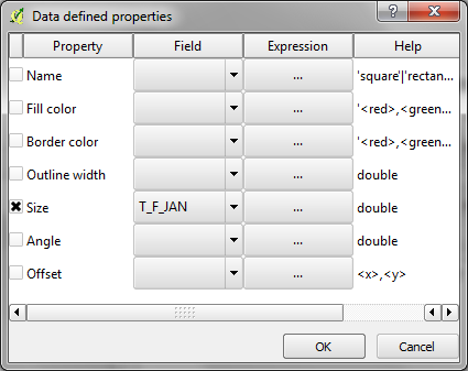
Data defined properties
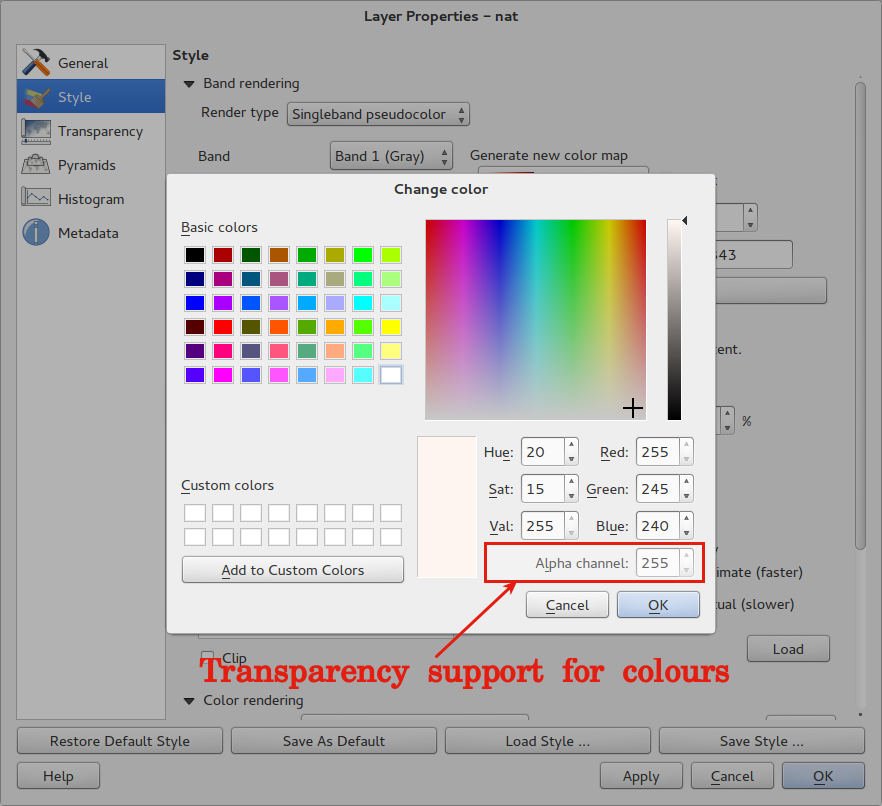
Support for transparency in colour definitions
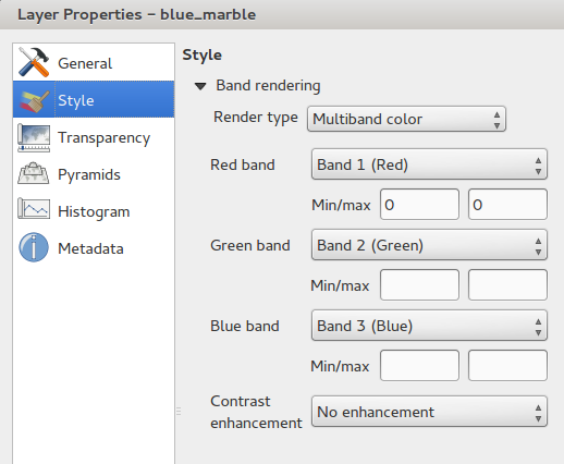
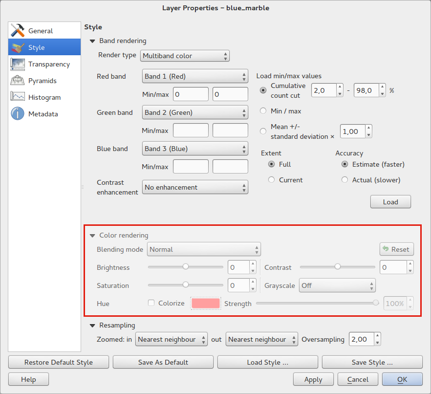
Color Control for Raster Layers
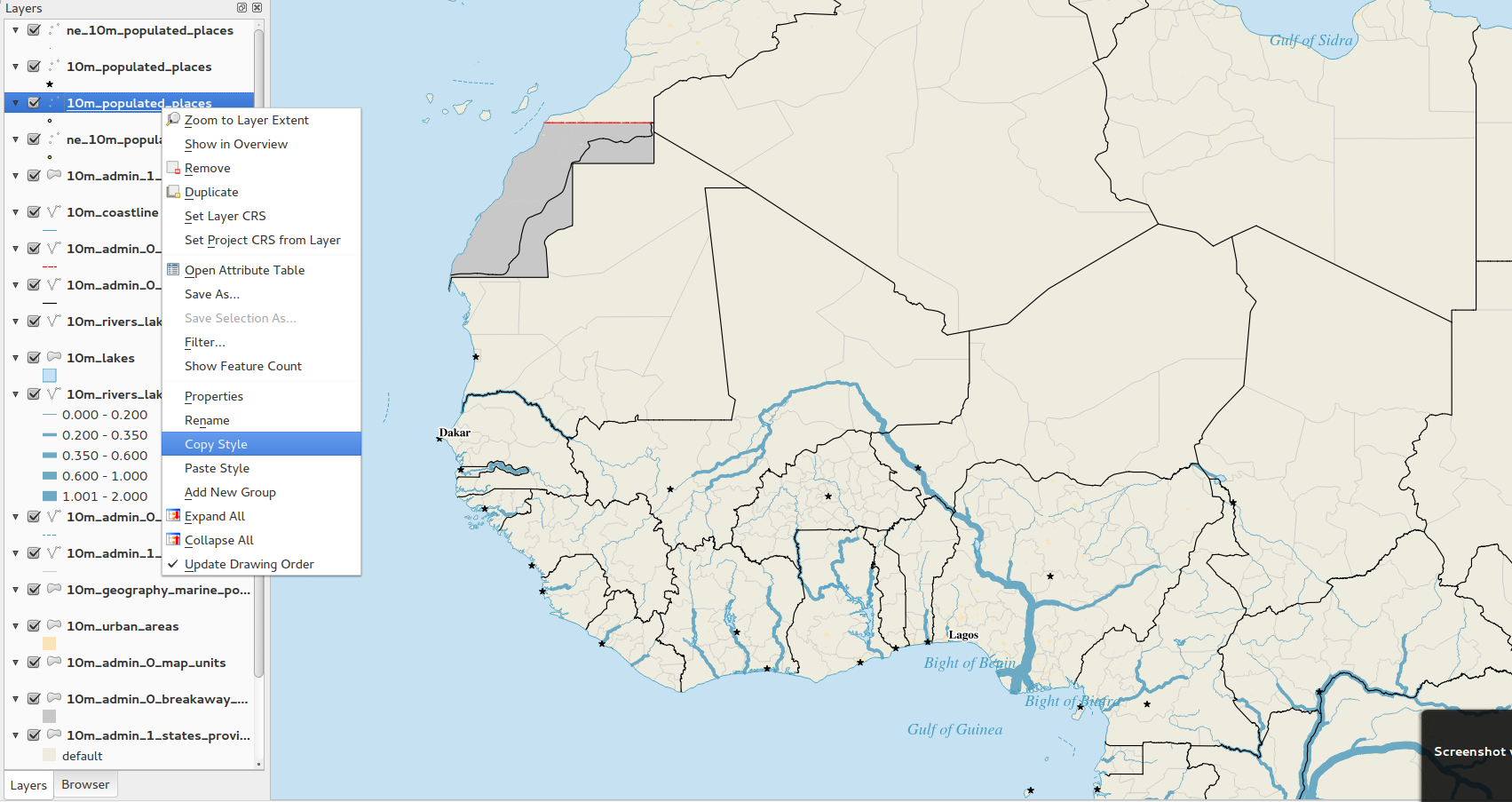
Copy symbology between layers
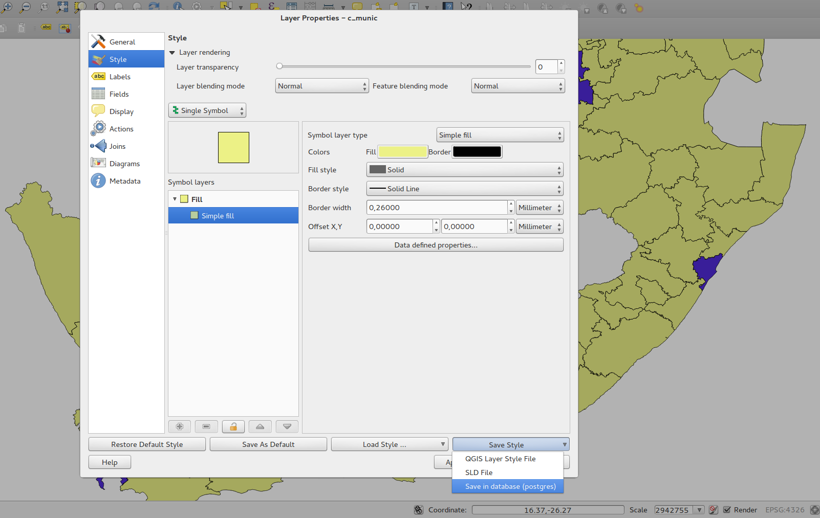
Save styles in your database
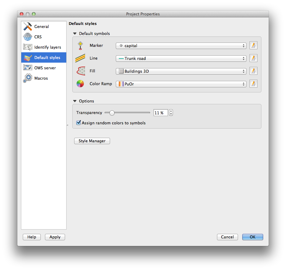
Set custom default styles for all layer types
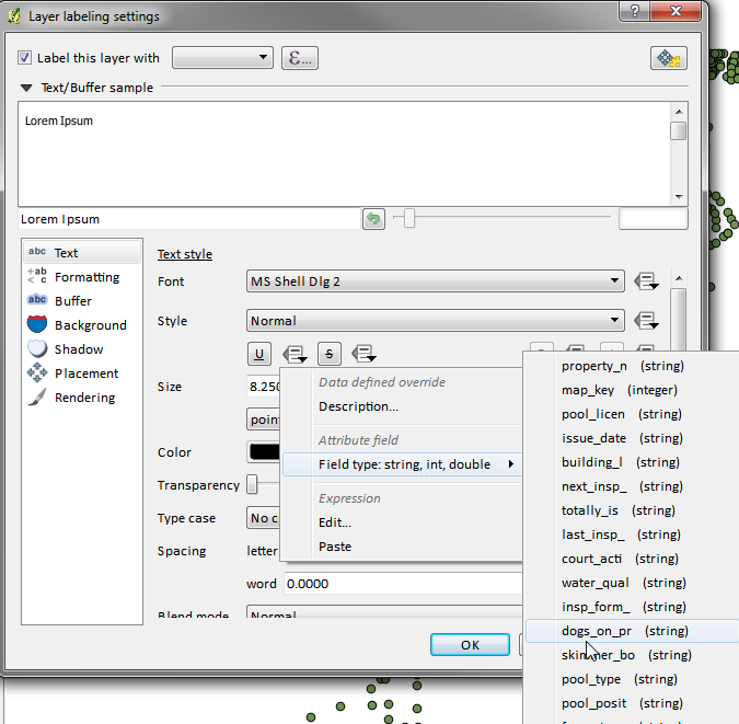
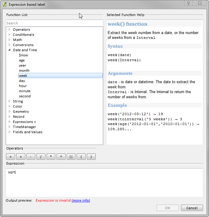
Expression based label properties
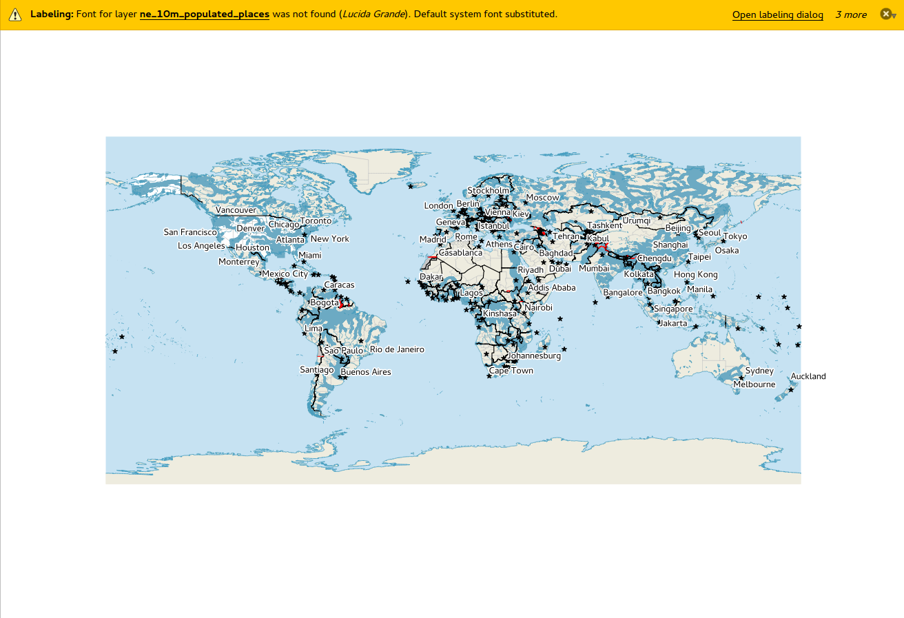
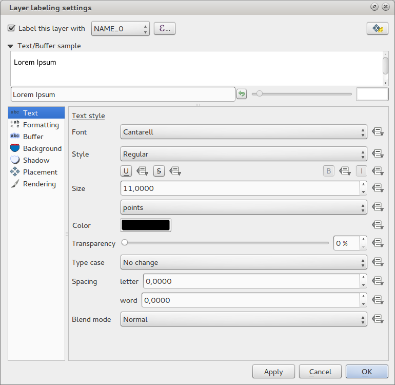
New labelling system
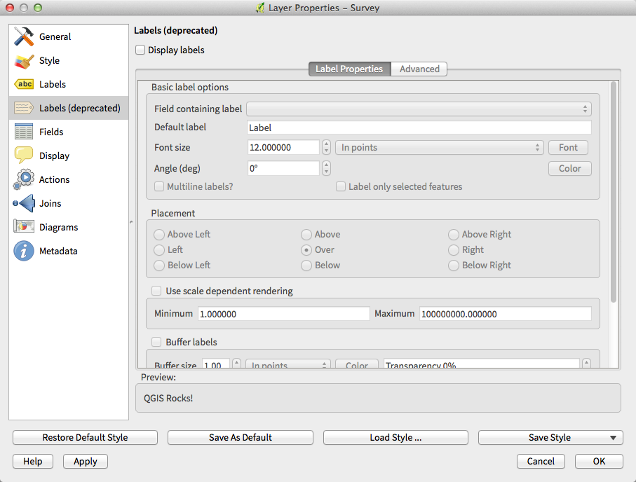
Older labelling engine deprecated
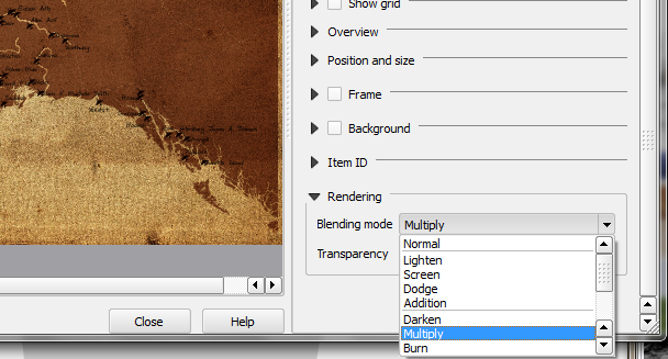
Layer blending
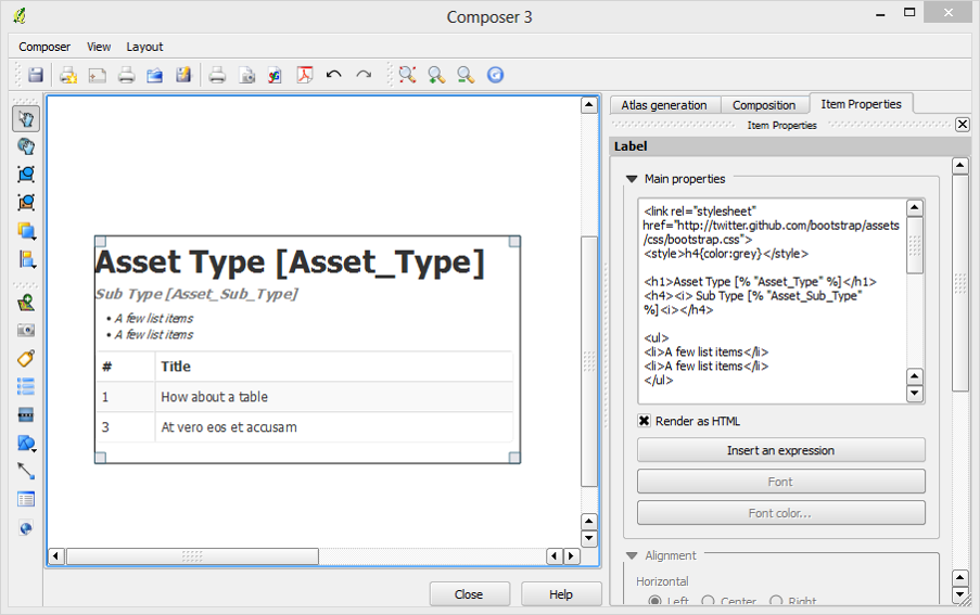
HTML Label support
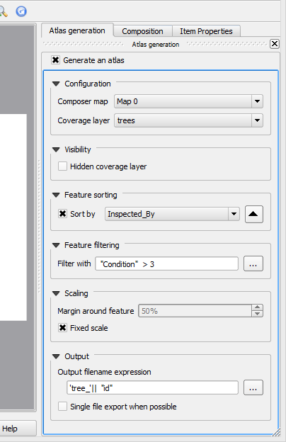
Map series generation
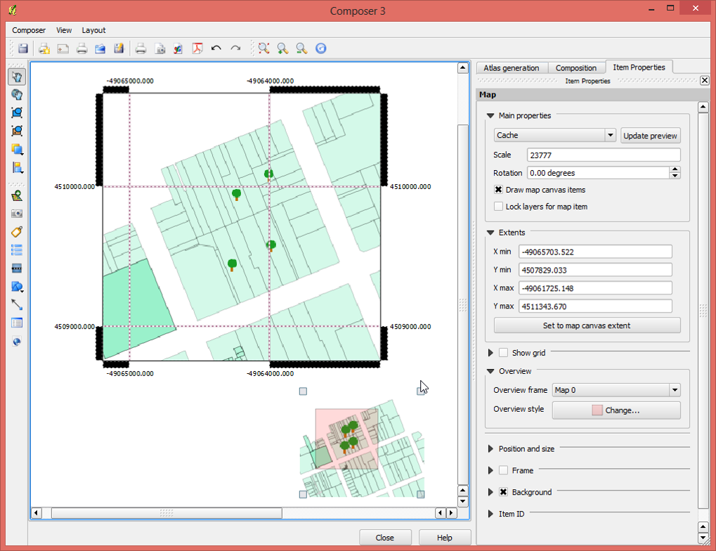
Automatic overview support in map frame
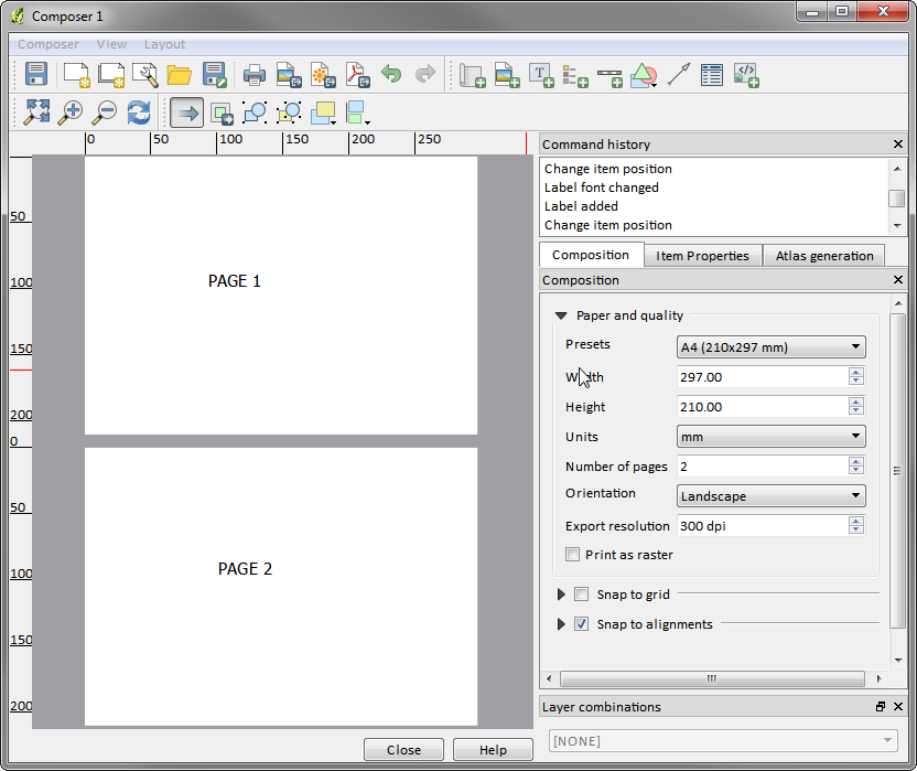
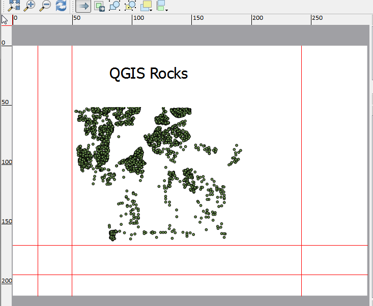
Multipage support
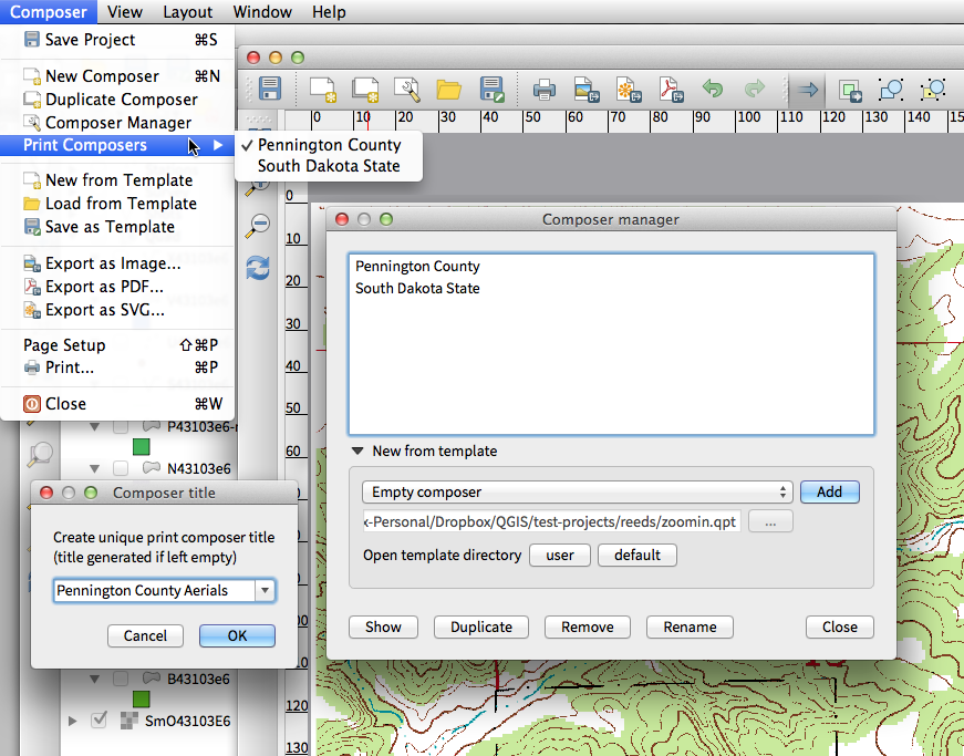
Updates to map composer management
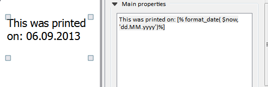
Expressions in composer labels
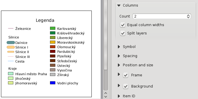
Multicolumn composer legend
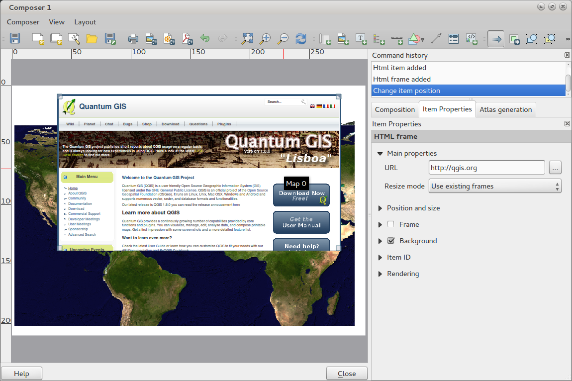
HTML Map Items
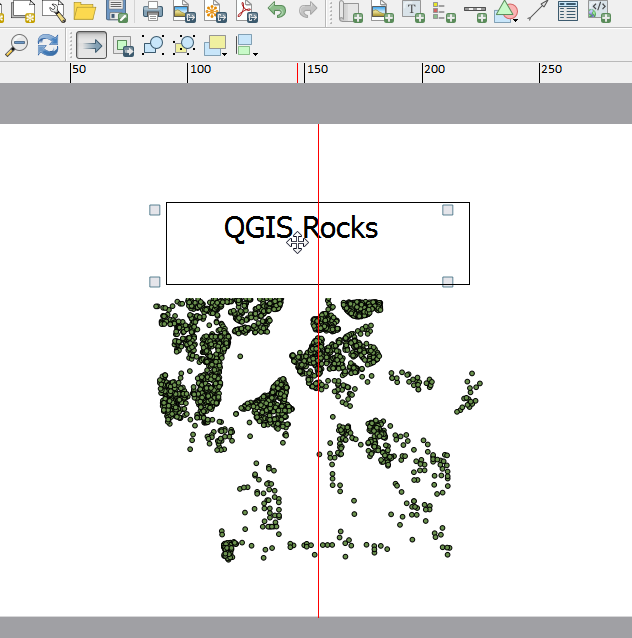
Auto snap lines
Manual Snap Lines
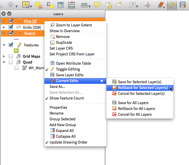
Multi-layer toggle editing commands
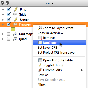
Duplicate existing map layer
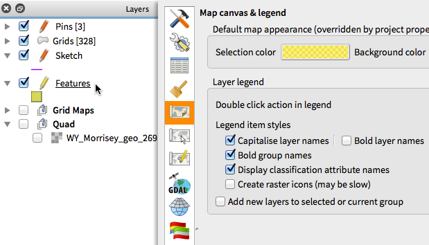
Legend visual feedback and options
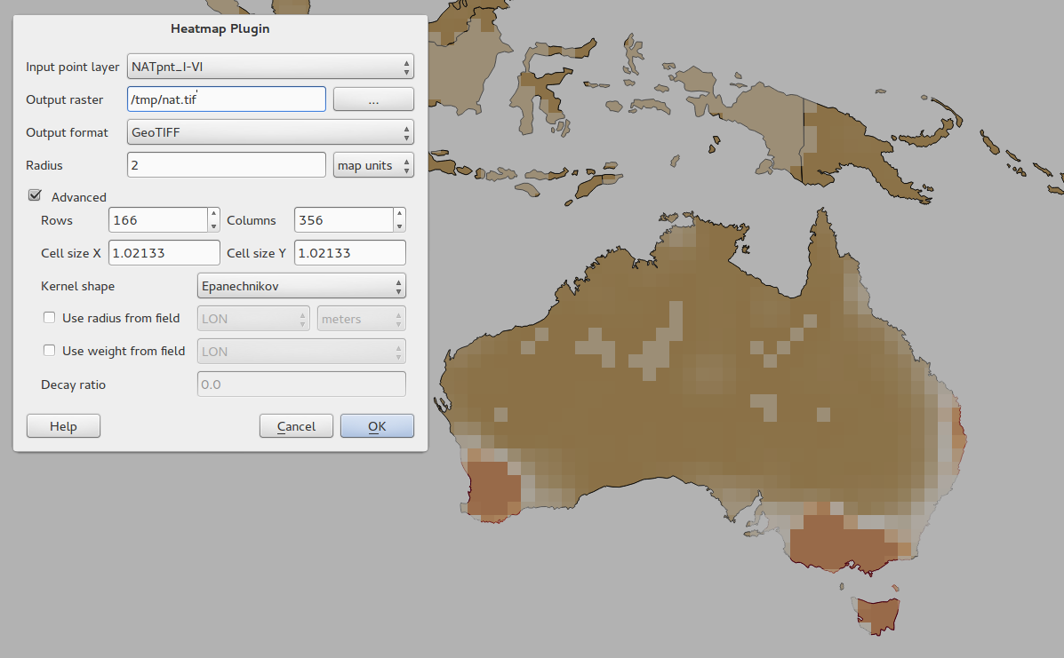
Heatmap Plugin Improvements
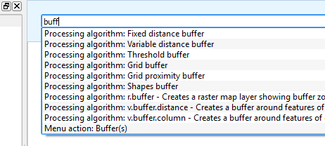
Processing Commander
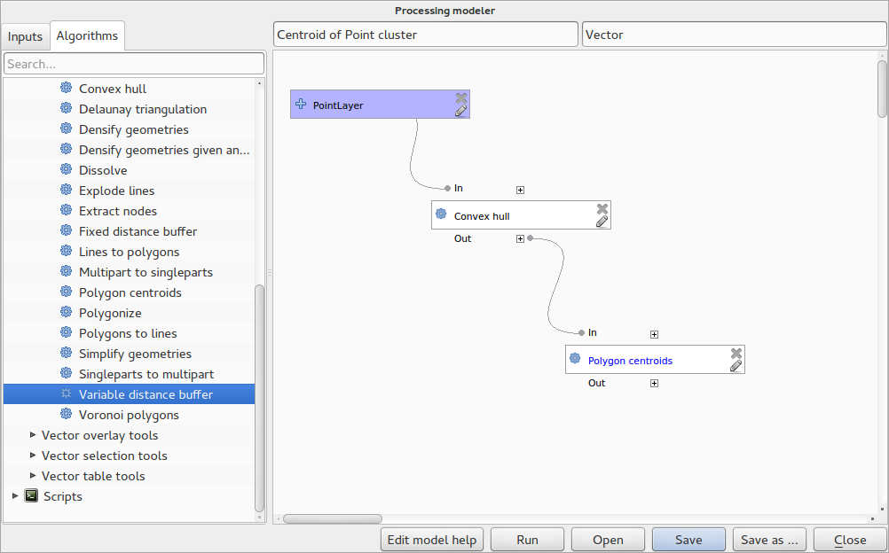
Processing Modeller
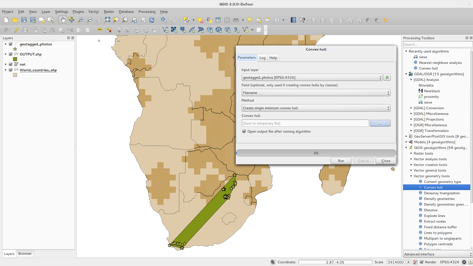
Processing Support
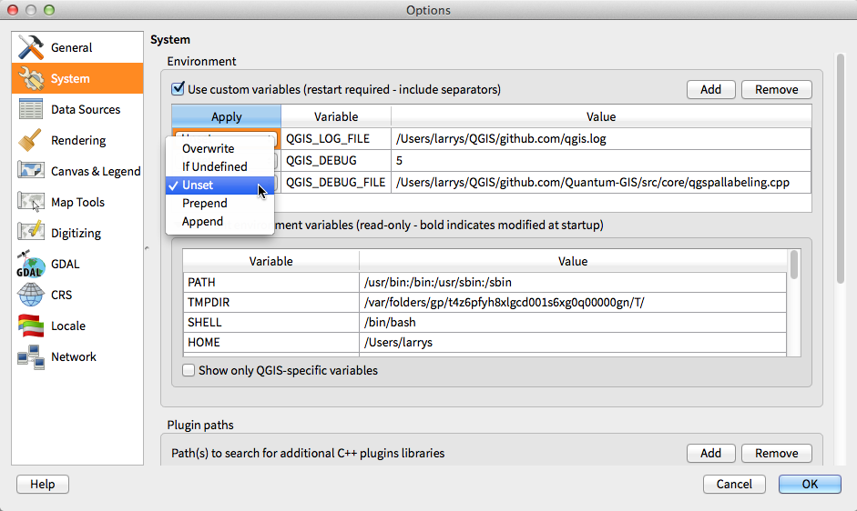
System environment variables
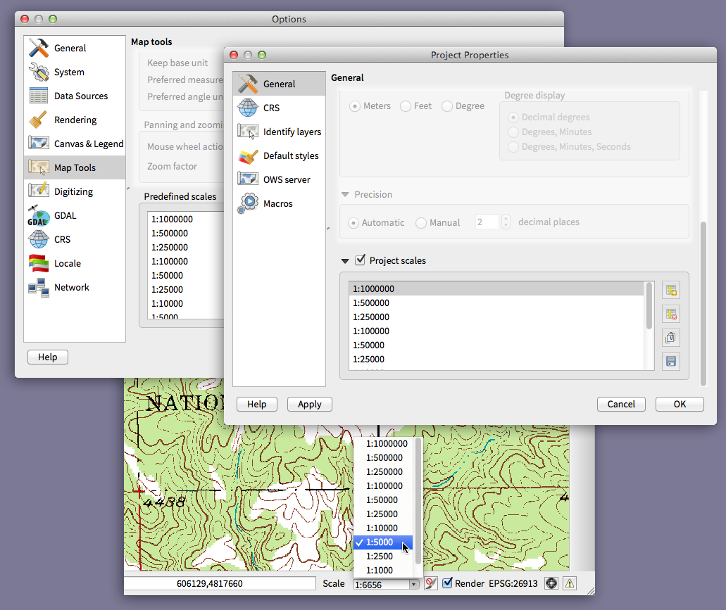
User-defined zoom scales
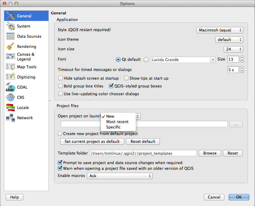
Define default startup project and project templates
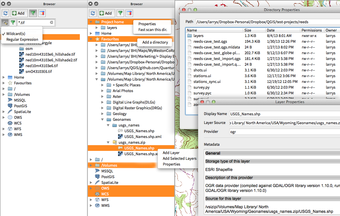
Improvements to in-app browser panel
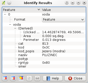
WMS identify format
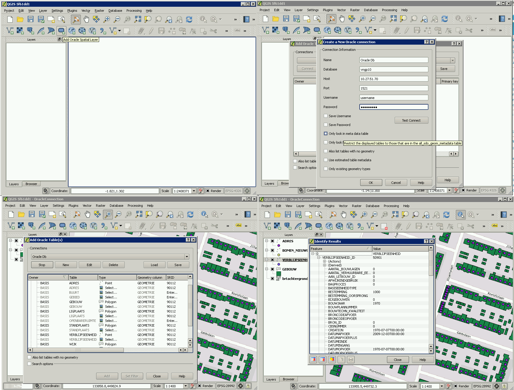
Oracle Spatial support
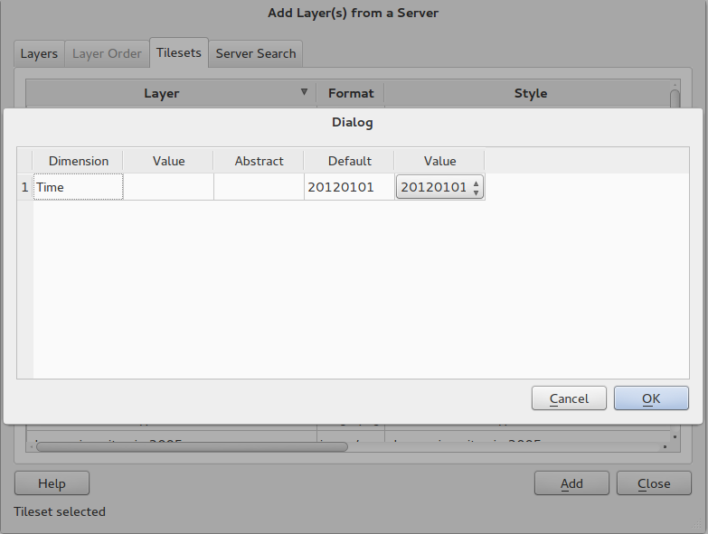
WMTS Support
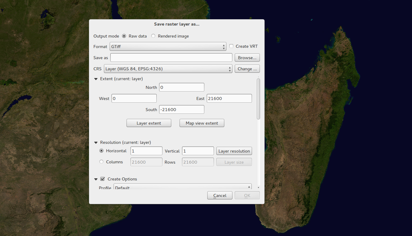
Raster Data Provider overhaul
Web Coverage Service provider added
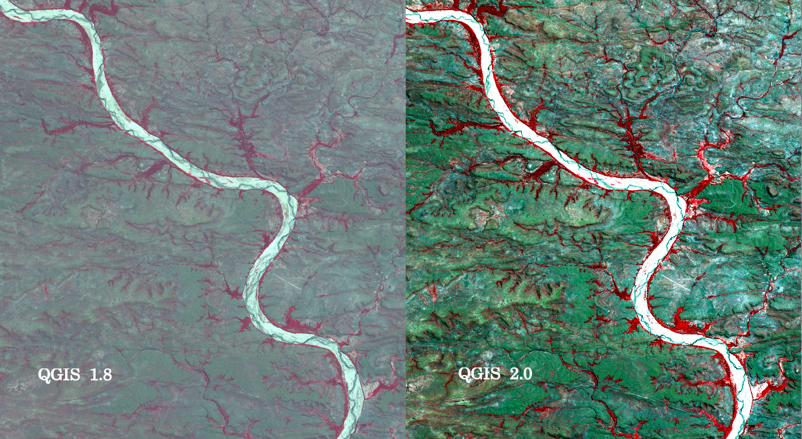
Raster 2% cumulative cut by default
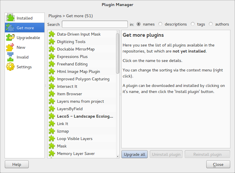
Revamped plugin manager
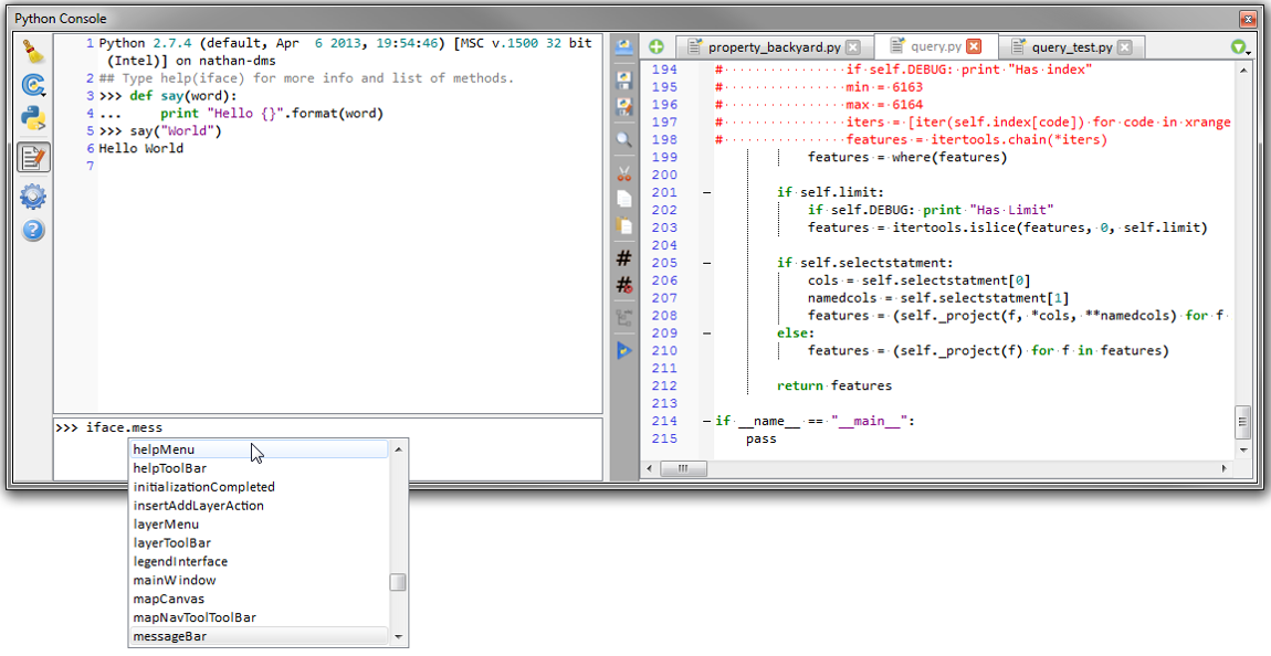
New Python Console
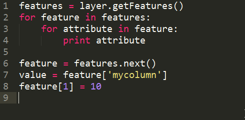
New cleaner Python API
Even more expression functions
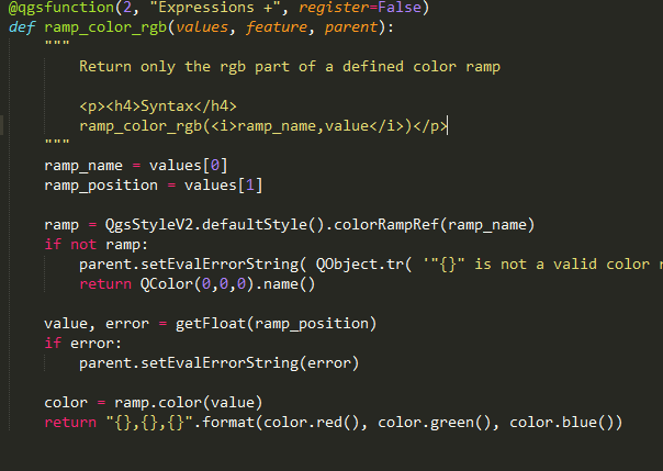
Custom expression functions
Code compatibility with version 1.x releases
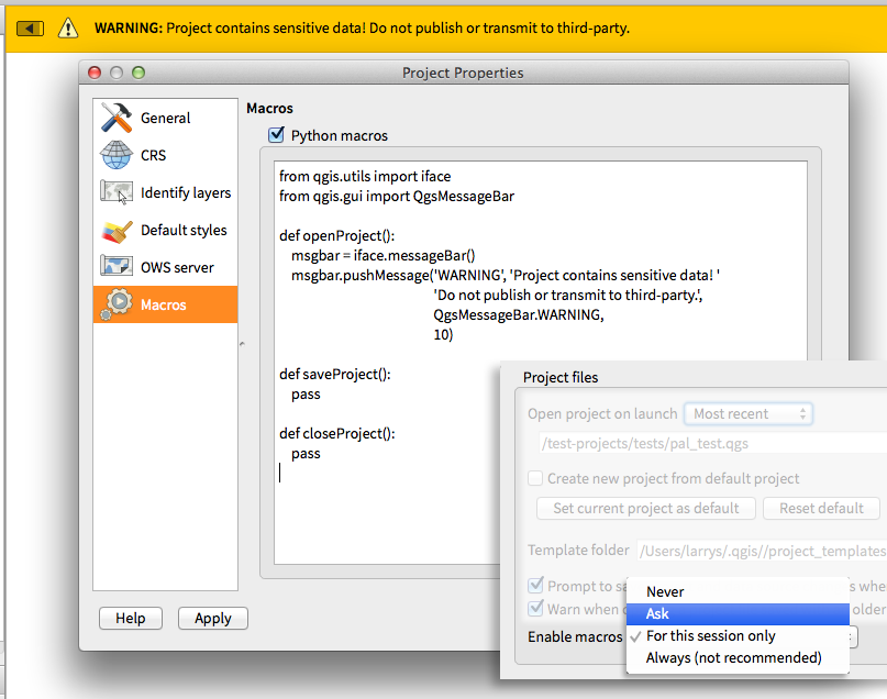
Python project macros
This application was created by Kartoza (Pty) Ltd. Available on GitHub! Version: 2.3.1