Project: QGIS
Version: 3.2.0
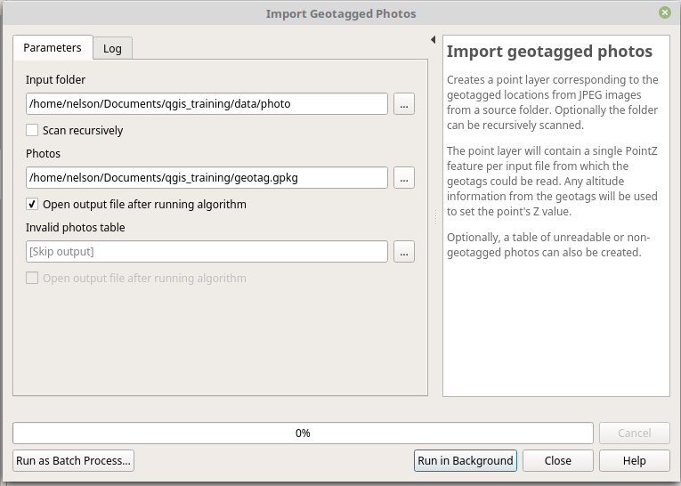
In QGIS 3.2 a new "Import geotagged photos" algorithm has been added to Processing. It allows selection of a folder which it will scan for jpg files which have been geotagged and
creates a PointZ layer with the result, with attributes for photo path, altitude, direction and timestamp.
Optionally the scan can be recursive and you can create an optional table of photos which could not be read or which were missing geotags.
The algorithm automatically sets the output table to use an external resource widget to display the linked photos in the attribute form.