Project: QGIS
Version: 3.42
The advanced digitizing panel and snapping options have been added to the georeferencer interface to offer users more control over reference points when aligning datasets.
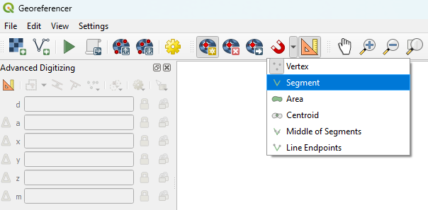
This feature was developed by Denis Rouzaud