Project: QGIS
Version: 3.24
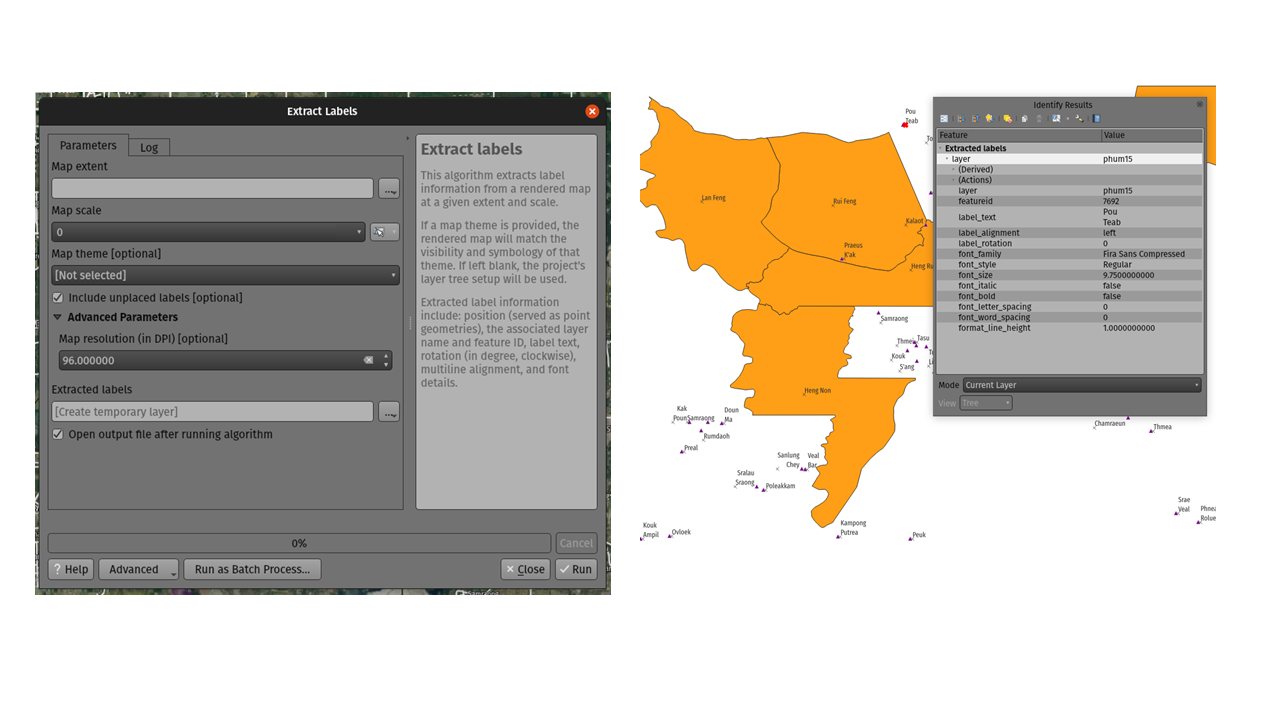
For 3.24 we added a new tool to QGIS' processing toolbox: "Extract labels". As its name hints at, this algorithm extracts label information from a rendered map at a specific extent and scale.
Extracted label information include its position (as point geometries), the associated layer name and feature ID, as well as label appearance properties such as rotation, text, alignment, font family, size, weight, etc.
The algorithm also generates a default symbol-less & labelled style for the output layer which allows for those saved layers to be drag and dropped into projects and have the label drawn exactly as they were exported.
If a map theme is specified when extracting labels, the exported labels will match the visibility and symbology of that theme. If left blank, the project's current visible layers will be used.