Project: QGIS
Version: 3.24
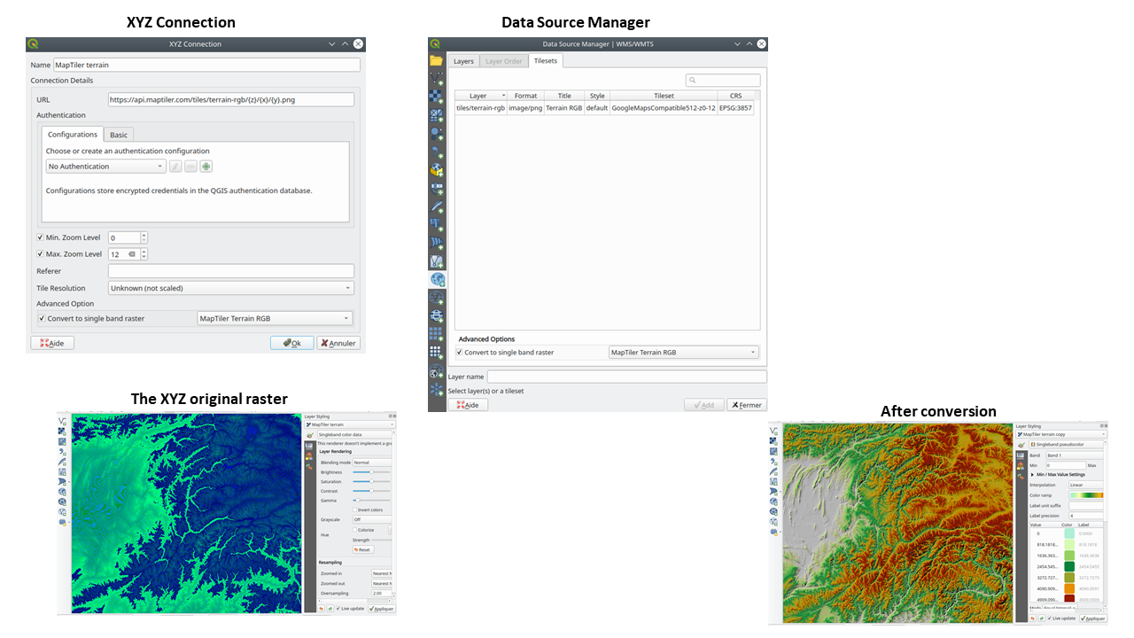
In QGIS 3.24 we've introduced the possibility to convert WMTS/XYZ raster datasets to a raster layer of single band float type following a predefined encoding scheme.
You can activate this option and choose an encoding scheme (for now, "MapTiler Terrain RGB" or "Terrarium Terrain RGB" are available) in the source settings of the XYZ connection or in the Data Source Manager when adding a WMST layer.
The selected converter will translate the RGB source values to float values for each pixel. After loading, the layer will be presented as a single band floating point raster layer, ready for styling using a pseudocolor or hill shade renderer!
This feature was funded by MapTiler
This feature was developed by Lutra Consulting (Vincent Cloarec)