Project: QGIS
Version: 3.24
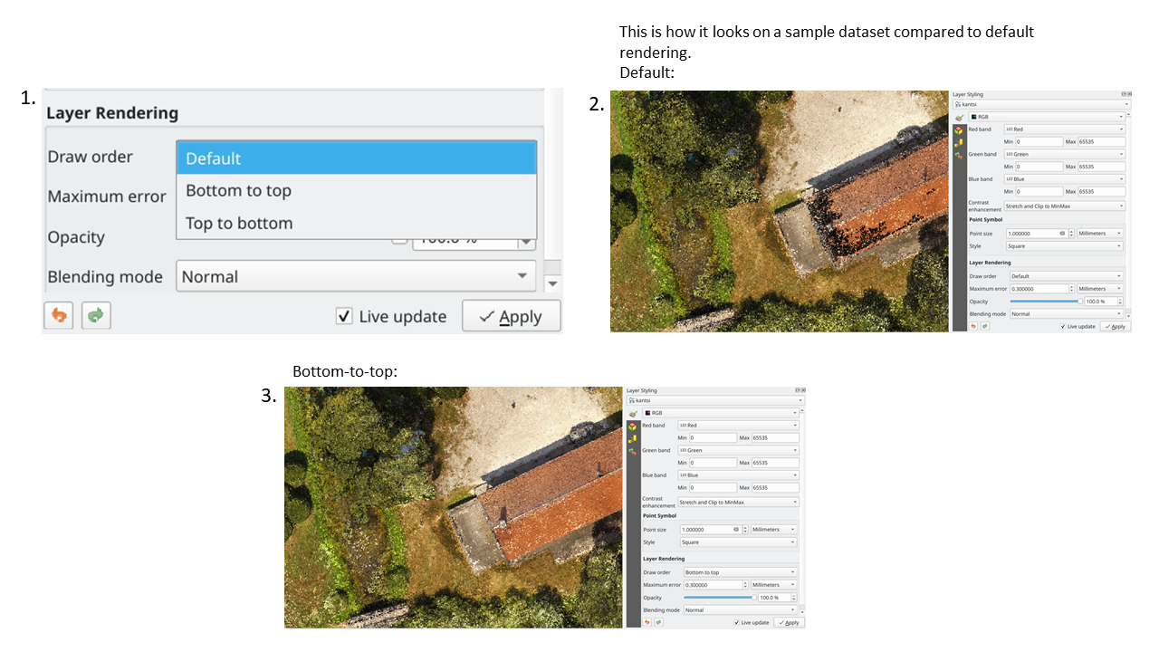
We've added an option to render point clouds according to their Z-order in 2D map views. With the new bottom-to-top ordering option enabled, points with larger Z values will cover lower points -- resulting in the appearance of a true orthographic photo. There's also an option for reverse sorting (top-to-bottom), where the scene appears as if viewed from below.
This feature was funded by Crowdfunding: Enhancing elevation data and point clouds in QGIS
This feature was developed by Stefanos Natsis (Lutra Consulting)