Project: QGIS
Version: 3.16
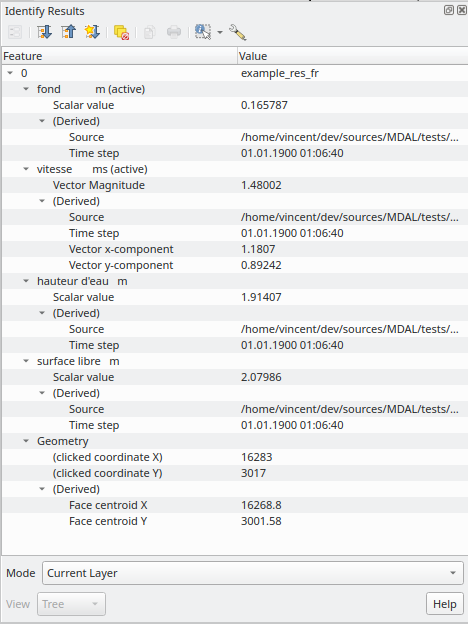
The identify tool has been adapted when used on mesh layers and now displays the dataset value corresponding to the current time of the temporal controller for all dataset groups. The active dataset groups (scalar and eventually vector) are first displayed, then the other dataset groups.
There is also other information displayed, including:
- Source where the dataset is stored
- Time step of the dataset that is displayed (can be different than the time of the temporal controller). Displays nothing if the dataset group is not temporal
- Centroid of the corresponding face
- Coordinate of the snapped vertex (if one is snapped)
- Center of the snapped edge (if one is snapped)
When the map canvas does not have temporal navigation enabled, the identify results contain only information about the active dataset groups which have static datasets defined in the mesh properties dialog.
This feature was funded by Artelia Group
This feature was developed by Lutra Consulting (Vincent Cloarec)