Project: QGIS

Changelog for version: 2.18.0

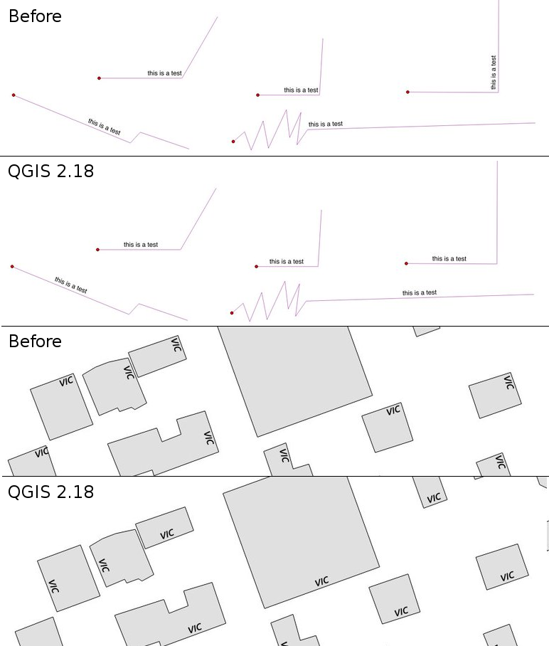
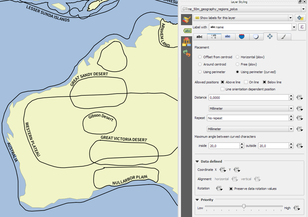
This is the last release in the 2.x series. The current Long Term Release (LTR) remains version 2.14.x. This release provides incremental improvements over our previous release. The majority of activity is currently focussed towards the development of QGIS 3.0 which is our next generation release planned for the end of the first quarter of 2017.


General

Automatic links in identify results

General

Mouse wheel over color dialog sliders

General

Add custom color schemes to color button drop down menu

Symbology

Color picker is now embedded in layer style panel

Labelling

Improved line label placement algorithm

Labelling

Substitution list support for labeling

Labelling

Label polygons using curved labels along perimeter

Rendering

Cancellable rendering of rasters (WMS, WMTS, WCS and XYZ layers)

Rendering

Preview of raster tiles (WMTS and XYZ layers)

Print Layouts

True North Arrows

Data Management

Add flag to only copy selected features

Forms and Widgets

Allow controlling labels for individual edit widgets

Forms and Widgets

Client side default field values

Forms and Widgets

Conditional visibility for tabs and group boxes

Processing

Merge connected lines algorithm

Processing

Geometry boundary algorithm

Processing

Bounding boxes algorithm

Processing

Optimised processing clip algorithm

Processing

Processing dissolve algorithm accepts multiple fields

Processing

Point on surface algorithm

Data Providers

Native support of XYZ tile layers

QGIS Server

Possibility to segmentize feature info geometry in server

Plugins

DB Manager: Add the ability to update SQL Layer

Programmability

New PyQGIS classes in 2.18

Programmability

New expression functions

Programmability

Expose GEOS linear referencing function to QgsGeometry