

Map legend in context
“A legend is used to decode the symbology applied to layers. The legend details the colour schema , symbolisations and how data is categorised”
Maps are used as a visual tool to interpret data and show the spatial relationship between data. One of the most important elements of a map is the legend as it allows people to interpret the symbology and decode the meaning of the colour applied to vector and raster layers. In this module, we look at how to produce a map with a legend that is easy to interpret.
You try:
Goal: To explore options for creating map legends
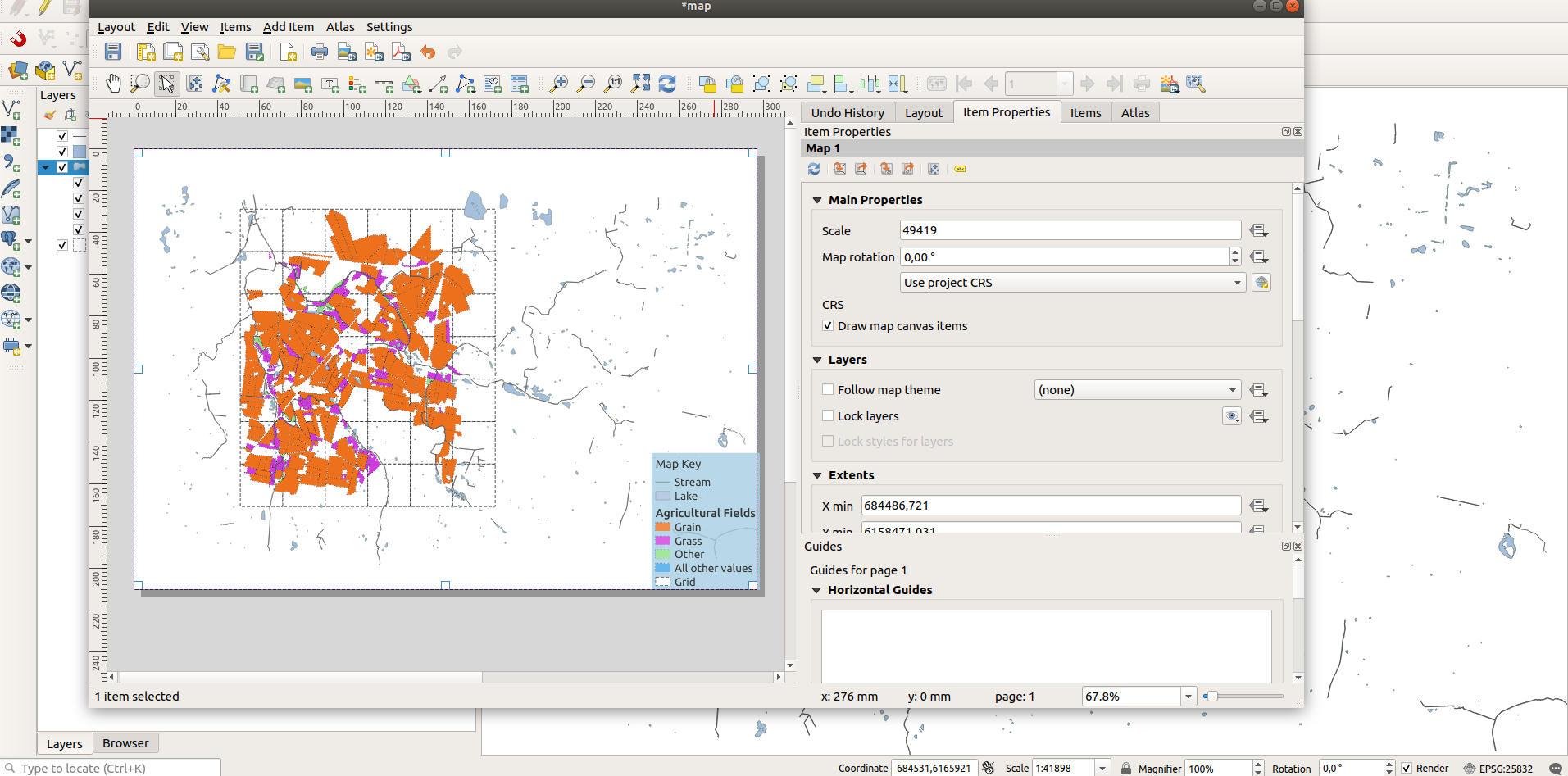
- Add the layers from the exercise folder and arrange them in a sensible order.
- Add a map.
- Add a Legend. Place the legend in a position where it does not obstruct the rest of the map.
- In the Item Properties of the Legend toggle Auto Update to off on Legend items.
- Select each layer and change its name according to the table below.
| Name | Legend Name |
|---|---|
| stream | Stream |
| lake | Lake |
| grid | Grid |
| fields | Agricultural Fields |
- There is a legend item in the Agricultural Fields that doesn't have a description. Set it to
All other values - Change the rendering order of your legend items to the following Stream > Lake >Grid and Agricultural Field
- Change the other properties of the legend according to the specification listed below.
| Name | Expectation |
|---|---|
Map Legend |
Font Size:16,Sub-group Font: Size 16 and Bold,Bg-color:#A6cee3,Bg-transparency:80 |
More about legends
A map legend or key is a visual explanation of the symbols used on the map. It typically includes a sample of each symbol (point, line, or area), and a short description of what the symbol means. Because map symbols meanings vary from region to region, a clear and concise legend is critical for conveying the distinctive characteristics of the map. The legend is related to the information on the map it is connected to. Creating a well laid out legend will enhance the overall shape of the maps visual appearance. In this example, we explored how legends can be added to QGIS and modified in map composer.

Check your knowledge:
-
What do the legend colours mean:
- They are just nice colours that can be changed
- The symbology of layers
- It shows statistics about the number of features in a layer
-
Which of the following combination must a map constitute to be complete:
- Map layers, legend and north arrow
- Map legend , north arrow , scale bar and legend
- Legend, scale bar and map title
